 Washington
Washington
Washington
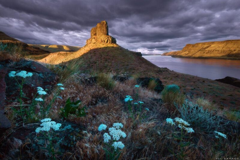
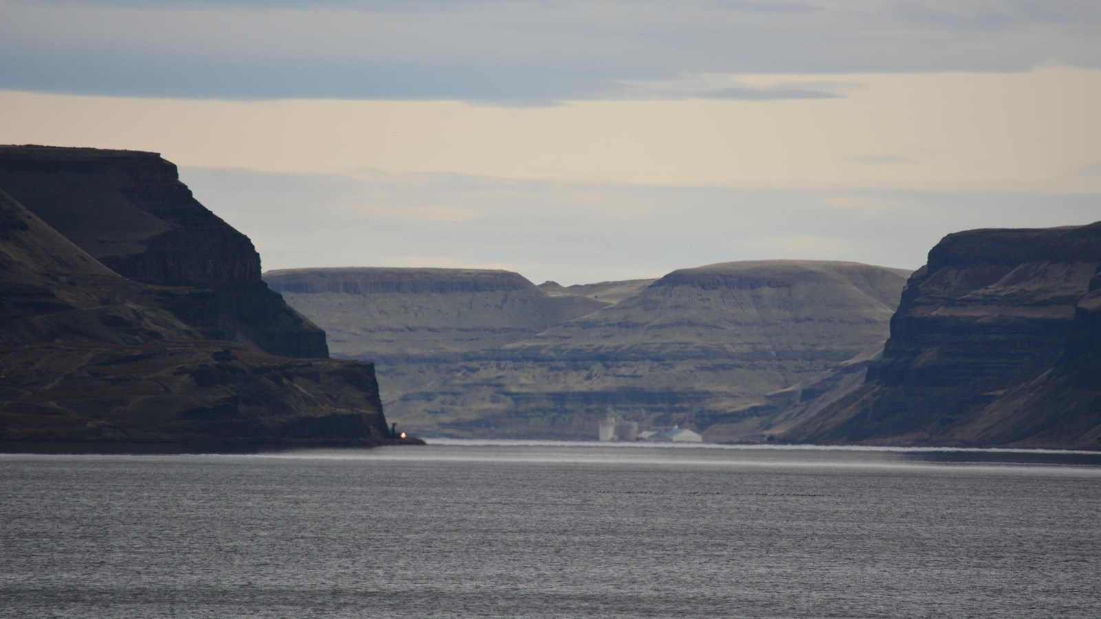
Every drop of floodwater from the largest deluge in North American history had to squeeze through this single mile-wide notch in the Horse Heaven Hills -- and the result was beyond anything the modern world has witnessed. During peak...
Every drop of floodwater from the largest deluge in North American history had to squeeze through this single mile-wide notch in the Horse Heaven Hills -- and the result was beyond anything the modern world has witnessed. During peak Missoula Flood events, an estimated 386 million cubic feet of water per second roared through Wallula Gap, a flow rate ten times the combined discharge of every river on Earth today. The bottleneck backed floodwaters hundreds of miles upstream, creating temporary Lake Lewis across the entire Columbia Basin -- a body of water that stretched from Pasco to Lewiston and rose 1,250 feet above sea level. The gap's towering basalt walls, rising more than 1,000 feet, bear scoured rock faces, massive gravel bars, and high-water marks etched by dozens of separate flood cycles over roughly 2,500 years. The iconic Twin Sisters rock pillars standing in the river are erosional remnants that survived the onslaught. Stand at Wallula Gap and you are standing at the single most important bottleneck in the entire Ice Age Floods story -- the chokepoint that determined how fast an inland sea could drain to the Pacific.
The gap itself is the Columbia River notch through the Horse Heaven Hills, with US-730 running along the east bank between Pasco and Umatilla. The most-used public access is the Twin Sisters pullout off US-730, about two miles south of its junction with US-12; a 0.7-mile out-and-back trail climbs to the Twin Sisters basalt pillars and the interpretive sign at the trailhead. No fee, no facilities; dog-friendly; climbing on the rocks is prohibited by Walla Walla County ordinance. Surrounding land is private ranchland, stay on the main trail.
Wallula Gap is the single most important hydraulic constriction in the Missoula floods story. The gap is roughly 1 mile (1.6 km) wide; flood discharges of 5–15 million m³/s through this single bottleneck could not pass quickly enough, so water backed up across the Pasco Basin into a temporary hydraulically dammed lake (Lake Lewis) with a surface area of ~4,500 mi² and a maximum depth of ~900 ft (275 m). The Balbas et al. (2017) 10Be study dated an ice-rafted erratic at 341 m elevation at Wallula Gap to 18.2 ± 1.6 ka, just 25 m below the highest evidence of flood inundation (~365 m above sea level) at this constriction, this is the anchor date for the peak Missoula flood and is the principal reason "18.2 ka" has replaced older "15 ka" or "13 ka" estimates in current literature. Field evidence (high-water silt lines, erratics) gives flood depths of 280–300 m at the Pasco Basin–Wallula Gap transition, although hydraulic-model calculations suggest a lower water depth of ~190 m, a discrepancy still discussed in the literature. The Twin Sisters basalt pillars and the high silt lines on the gap walls were sculpted under hundreds of feet of floodwater. Wallula Gap was designated a National Natural Landmark in 1980.
Balbas et al. (2017) remains the anchor study. The O'Connor, Baker, and others (2020) review in Earth-Science Reviews (and the USGS open-file equivalent) treats Wallula Gap as the key hydraulic control on the Missoula floods downstream of the Pasco Basin and reconciles the 280–300 m field evidence with the lower model-derived depths. No newer site-specific cosmogenic or paleomagnetic work has superseded these.
The IAFI Lake Lewis Chapter (covering the Tri-Cities) treats Wallula Gap as its signature site and has published the Lake Lewis Floodscape brochure; the chapter runs occasional Twin Sisters / Wallula field trips. Wallula Gap is also formally listed as a National Natural Landmark and an Ice Age Floods National Geologic Trail feature.
Best visited spring or fall, summer can be very hot with little shade. Pair the Twin Sisters trail with the Hat Rock State Park viewpoint across the river on the Oregon side and the Wallula Gap Overlook on US-12 north of the gap for a full upstream / downstream comparison.
Ice Age Floods National Geologic Trail
The Horse Heaven Hills are the southern border of the Central Basin area of the Columbia Basin and the Wallula Gap is the opening through which all of the Columbia and Snake River waters escape the basin. Wallula Gap is the largest, the most spectacular and the most significant of the several large water gaps through basalt anticlines in the Columbia Basin.
During the Pliocene and early Pleistocene the thick basalt flows of what is now southern Washington were wrinkled and uplifted into a long northeast-southwest trending anticlinal ridge which we call the Horse Heaven Hills. The uplift of this structure was more rapid than the ability of the ancestral Columbia River to down-cut, thus a great lake, Lake Lewis, was impounded in the Pasco Basin area. The remains of the lake beds formed in this lake are the Ringold Formation.
Once Lake Lewis was filled to overflowing, it established an outlet over the lowest saddle in the ridge at the location of Wallula Gap. The Columbia then poured down the steep south flank of the Horse Heaven Hills anticline in cascades and waterfalls which eroded slowly downward and head-ward until the ridge was completely breached, Wallula Gap was formed and the waters of Lake Lewis, along with considerable quantities of the Ringold sediments, drained down the Columbia Gorge into the sea. During the late Pleistocene the greatly increased melt-waters from the ice sheets and Cascade glaciers caused floods, perhaps annually, which also encountered the constriction of Wallula Gap. The gap may have also been dammed by jammed icebergs and ice cakes, causing the temporary and intermittent rebirth of Lake Lewis.
This ephemeral lake left bottom deposits called the Touchet Beds. These giant floods filled the basin with a great temporary lake, which rapidly drained out through Wallula Gap. At the height of the Ice Age Floods the water flow through Wallula Gap has been estimated at 166 cubic kilometers (40 cubic mil
Flood-extent overlay shows the maximum reach of the Missoula Floods.
The site in its place along the flood path, with the maximum flood extent drawn over the modern map.
View on the interactive map Searchable sites · 360° trails · flood reconstruction