 Oregon
Oregon
Oregon
The Tualatin Public Library, just off Interstate 5 in suburban Oregon, is home to an unexpectedly dramatic display of Ice Age megafauna -- including a mastodon, Columbian mammoth, and giant ground sloth -- found in the flood deposits of...
The Tualatin Public Library, just off Interstate 5 in suburban Oregon, is home to an unexpectedly dramatic display of Ice Age megafauna -- including a mastodon, Columbian mammoth, and giant ground sloth -- found in the flood deposits of the Tualatin Valley. The library features a striking display of fossils and replicas that bring the Pleistocene to life, set against the backdrop of the flood geology that preserved them. The Tualatin area was repeatedly inundated by the Missoula Floods, which backed up from the Columbia Gorge and filled the Willamette Valley to approximately 400 feet above sea level. Between flood events, the valley's rich sediments supported lush vegetation that attracted megafauna, whose remains were then buried and preserved by subsequent flood deposits. The library's ice age exhibit makes this suburban community an unlikely but fascinating stop on the Ice Age Floods trail, where you can see the bones of animals that lived and died in a landscape periodically devastated by the most powerful floods in North American history. A public library has never felt so geologically consequential.
The Tualatin Public Library is at 18878 SW Martinazzi Avenue in Tualatin, Oregon. Open standard library hours seven days a week; admission free. The library serves as Tualatin's interim visitor center for the Ice Age Floods National Geologic Trail, visitors can have their NPS passport stamped here. The mastodon skeleton is on permanent display.
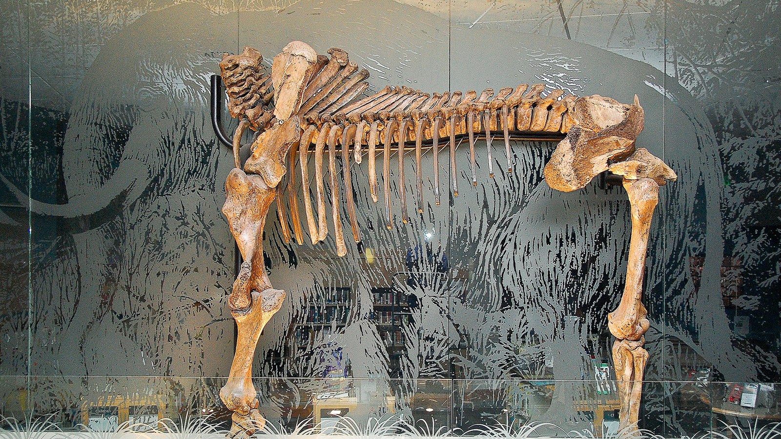
The library houses the city's signature Ice Age artifact: a mostly articulated mastodon skeleton unearthed in 1962 by two Portland State University students from a Tualatin construction site. In March 2021, Dr. Andrew Boehm of the University of Oregon and colleagues proposed that the specimen may belong to the recently defined Pacific mastodon species (Mammut pacificus), not the more common American mastodon. Additional displays include the sacrum of a giant ground sloth, mammoth bones, smaller erratics, and replicas of an ancient bison skull and mastodon tusk. As at the Tualatin Heritage Center, the fossils and erratics here are byproducts of the same valley-wide inundations the floods produced, Tualatin sat at a flow junction subjected to more than 40 flood events between roughly 18.2 ka and 14.0 ka.
The Pacific mastodon taxonomic work (Dooley, Scott, and Green 2019; Boehm follow-on 2021) directly informs interpretation of the library's specimen. The library will eventually transfer its visitor-center role to the planned Willamette Valley Ice Age Interpretive Center being developed by the Tualatin Ice Age Foundation.
The Lower Columbia Chapter co-hosted the 2021 dedication of the library as the trail's interim visitor center. The library, the city, and IAFI partner on regular programming.
Year-round, free, family-friendly. The children's room includes hands-on Ice Age features. Pair with the Heritage Center, Ibach Park, and the Tualatin River Greenway for a full half-day in Tualatin.

Flood-extent overlay shows the maximum reach of the Missoula Floods.
The site in its place along the flood path, with the maximum flood extent drawn over the modern map.
View on the interactive map Searchable sites · 360° trails · flood reconstruction