 Washington
Washington
Washington
The Spokane River Centennial Trail traces a corridor that experienced some of the most violent flooding anywhere on the Ice Age Floods path, as the first waters released from the collapse of the Purcell Trench Ice Lobe dam came barreling...
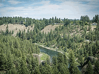
The Spokane River Centennial Trail traces a corridor that experienced some of the most violent flooding anywhere on the Ice Age Floods path, as the first waters released from the collapse of the Purcell Trench Ice Lobe dam came barreling through this valley. When the ice dam holding back Glacial Lake Missoula failed, an estimated 500 cubic miles of water -- equivalent to Lake Erie and Lake Ontario combined -- burst through what is now the Rathdrum Prairie and roared into the Spokane River valley at speeds approaching 65 miles per hour. The trail passes through terrain shaped by this initial outburst: scoured basalt channels, enormous gravel deposits, and the distinctive Bowl and Pitcher rock formation where giant basalt blocks were torn from cliffs and deposited in the river. Following the trail today, you walk alongside a river that once carried a volume of water greater than all the world's rivers combined, and the polished basalt outcrops and flood terraces along the path are your evidence. The 37-mile paved trail connecting Spokane to the Idaho border makes the flood story accessible by bike or on foot.
The Spokane River Centennial State Park Trail is a 40-mile paved, multi-use trail running from the Idaho state line through downtown Spokane to Nine Mile Falls and Riverside State Park. It is open year-round, free to use, and accessible from dozens of trailheads; a Discover Pass is required to park at state-park trailheads. The trail is managed by Washington State Parks in partnership with local jurisdictions.
The Spokane River valley was the primary conduit for floodwaters released from Glacial Lake Missoula. As the lake drained, water poured west through the Rathdrum Prairie and the Spokane corridor before fanning out across the Channeled Scabland. The trail passes flood-deposited gravel bars and cobbles that built the Rathdrum Prairie–Spokane Valley Aquifer, and crosses the Spokane Gorge where floodwaters scoured basalt at speeds estimated at 30–50 mph. Coyote Rocks, a stretch along the river featured in indigenous and settler history, owes its boulder field to the floods. The trail itself is a transit corridor through flood country rather than a single flood landform; interpretive signage at Riverside State Park (Bowl & Pitcher) is the densest concentration of geologic content.
No new trail-specific geologic research located. Broader 10Be cosmogenic work (Hanson, Clague, and colleagues, 2020) refined the chronology of the largest northwestern-route floods to 18.2 ± 1.5 ka, which informs the timing of deposition in the Spokane corridor.
The Cheney-Spokane Chapter of IAFI is active in the corridor, hosts regular field trips along the trail, and partners with the Spokane County Library District on programming (the "Carving the Columbia" event series is one example).
Spring through fall is the best riding/walking window; portions are plowed in winter but icy. The Riverfront Park downtown segment is the most urban and accessible; the Bowl & Pitcher area in Riverside State Park is the most scenic and the strongest single stop for flood geology.
Flood-extent overlay shows the maximum reach of the Missoula Floods.
The site in its place along the flood path, with the maximum flood extent drawn over the modern map.
View on the interactive map Searchable sites · 360° trails · flood reconstruction