 Oregon
Oregon
Oregon
Nearly 700 feet above the Columbia River, Rowena Crest is a scenic overlook that doubles as a front-row seat to one of the most dramatic chokepoints on the Ice Age Floods path. The narrow section of the gorge known as Rowena Gap, visible...
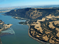
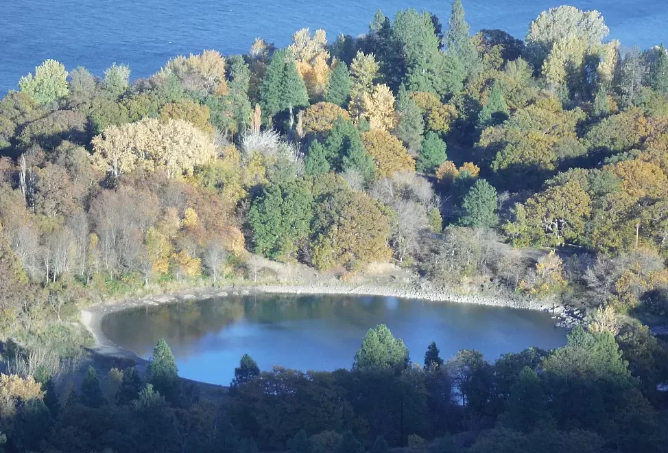
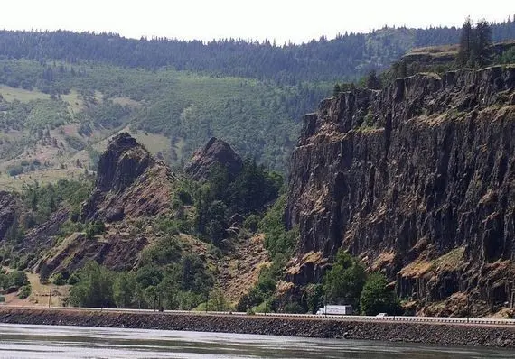
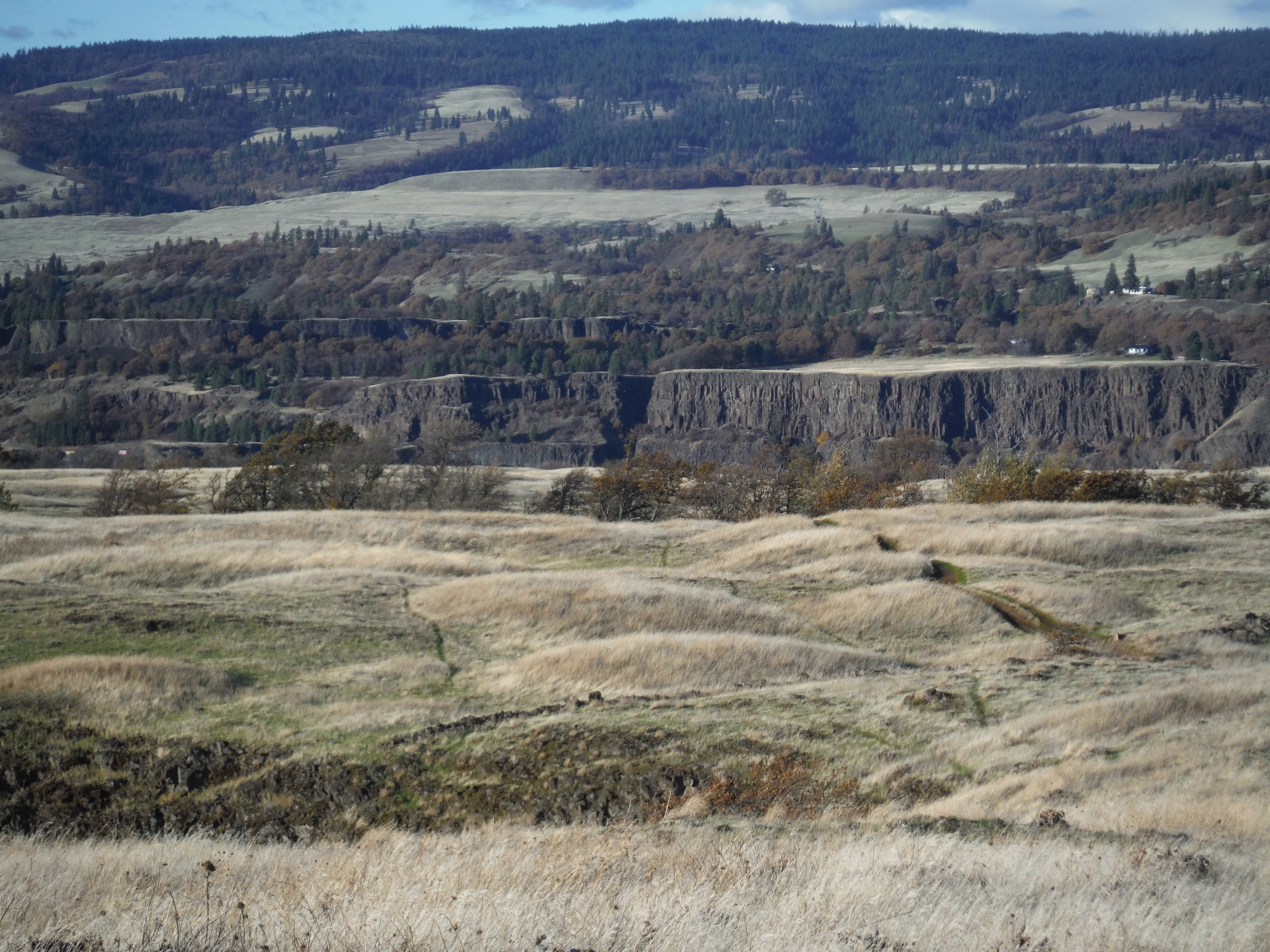
Nearly 700 feet above the Columbia River, Rowena Crest is a scenic overlook that doubles as a front-row seat to one of the most dramatic chokepoints on the Ice Age Floods path. The narrow section of the gorge known as Rowena Gap, visible directly below, forced the floods to slow and back up, creating temporary Glacial Lake Condon on the upstream side. The resulting dynamics carved kolk ponds into the Rowena Plateau -- circular depressions visible from the viewpoint that were drilled by the floods' underwater vortices. Massive slump blocks, sections of cliff that collapsed into the gorge after being undercut by floodwaters, are visible on the canyon walls. In spring, the Tom McCall Preserve below the viewpoint erupts in wildflowers -- balsamroot, lupine, and dozens of other species that thrive in the thin soils overlying flood-scoured basalt. The drive to the viewpoint on the old Historic Columbia River Highway is itself spectacular, with switchbacks through the gorge terrain. Standing at Rowena Crest, you can easily imagine the approach of the flood: a wall of muddy water, studded with icebergs and debris, rising relentlessly through the gap below until it filled the gorge wall to wall.
Open year-round, free, at the Rowena Crest Overlook on the Historic Columbia River Highway near Mosier, OR. ADA-accessible parking and viewpoint; the connected Tom McCall Preserve (Nature Conservancy) offers an easy 1-mile plateau loop and a more strenuous 3.4-mile round-trip up McCall Point. Trail closed January–April for wildlife protection on the McCall Point spur; the plateau loop and viewpoint are open year-round. An Ice Age Floods historical marker is on site.
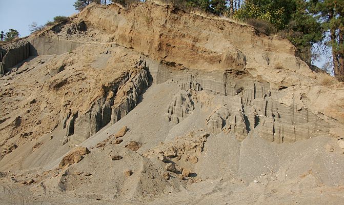
Rowena Crest sits roughly 700 feet above the Columbia at the upstream end of the Rowena Plateau. The major Rowena Gap immediately downstream acted as a hydraulic constriction during the Missoula Floods, forcing flood depths above 1,000 feet in this reach and ponding water temporarily upstream in the Dalles basin. The plateau itself was scoured to bedrock by water 200+ feet deep flowing over the top, the resistant Grande Ronde Basalt surface and the absence of soil cover record this. Tilted basalt slump blocks at the base of the cliff broke off as floodwaters undercut the promontory, and a kolk pond at river level was excavated by a giant flood-driven vortex behind the obstacle.
The 2020 USGS/Waitt review covers the Gorge constrictions including Rowena Gap; no new site-specific work since.
Direct IAFI Columbia River Gorge Chapter site; the Ice Age Floods historical marker at the overlook is part of the coordinated interpretive program for the Historic Columbia River Highway.
Best in late April through May for wildflower bloom (balsamroot, lupine, Tom McCall's deltoid balsamroot). The viewpoint alone is a 5-minute stop; add 1–3 hours for the McCall Preserve trails. The looped section of the historic highway here is one of the more photographed road segments in Oregon.
Scenic Rowena Crest and the Tom McCall Preserve area provide an incredibly scenic place to let your feet, and your imagination wander as you look out on a major chokepoint along the Ice Age Floods path. The wildflower displays are amazing during the Spring, but several compelling flood-related features are visible from the vantage of the Rowena Crest Viewpoint any time of year. Rowena Crest lies nearly 700 feet above the Columbia River at the upstream end of the Rowena Plateau, a miles-long plateau that the river flows along. Just upriver from the plateau is the narrow section of the Gorge known as the Rowena Gap The drive to the viewpoint on old Hwy 30 from either east or west is a spectacular ride through a wonderous section of the Columbia River Gorge. A roundabout parking area at the viewpoint, with a safety wall above a sheer cliff, provides a great observation point eastward toward Rowena Gap. At Rowena Crest it’s easy to imagine what it might have been like to witness the approach of those massive floods.
There is not yet scientific evidence that humans were in the area to bear witness to the Ice Age Floods, but there is solid evidence of humans in the Americas by that time. And there is growing concensus that if they came in during a glacial maximum, they would have come in by a coastal route that offered plentiful food and shelter for their journey. The mouth of the Columbia River would have been the first major waterway path inland that might have led them to settle in the area of the Floods.
Your village might have been situated across the Columbia at the mouth of the Klickitat River where the town of Lyle now sits. If you were foraging, or just relaxing, atop Rowena Crest on a late summer day, you might have felt the ground begin to temble as if there were a small earthquake, but the trembling would have slowly increased for a few hours. Eventually you would have heard a low roaring sound that also grew over an hour or more before you could see turbule


Flood-extent overlay shows the maximum reach of the Missoula Floods.
The site in its place along the flood path, with the maximum flood extent drawn over the modern map.
View on the interactive map Searchable sites · 360° trails · flood reconstruction