 Washington
Washington
Washington
The giant basalt boulders scattered through the Spokane River at Riverside State Park's famous Bowl and Pitcher area are not natural river deposits -- they are blocks ripped from 500-foot-high cliffs by the Missoula Floods and hurled into...
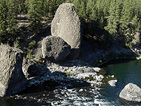
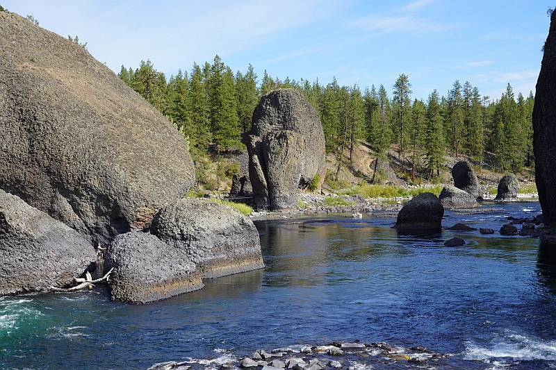
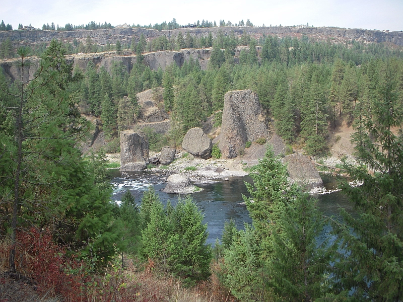
The giant basalt boulders scattered through the Spokane River at Riverside State Park's famous Bowl and Pitcher area are not natural river deposits -- they are blocks ripped from 500-foot-high cliffs by the Missoula Floods and hurled into the channel like pebbles. The 'Bowl' is a circular depression in the river and the 'Pitcher' is a massive detached column of basalt, both created when the initial outburst from Glacial Lake Missoula -- carrying an estimated 500 cubic miles of water -- roared through this canyon at speeds approaching 65 miles per hour. The floods stripped away thick deposits of sand and gravel, exposing the basalt benches on the west side of the river and leaving terraces of flood debris on the east side. At over 9,000 acres, Riverside is Washington's second-largest state park, with hiking, mountain biking, and horseback riding trails threading through a landscape where every rock formation tells the flood story. A suspension bridge crosses the river at the Bowl and Pitcher, offering views of the rapids created by those flood-deposited boulders -- a crossing that makes the geological violence viscerally present. This is where the floods first hit the Spokane area, and the evidence is everywhere.
Open year-round. Headquarters at 9711 W Charles Rd, Spokane, with the Bowl and Pitcher campground and day-use area at 4427 N Aubrey L White Pkwy. Over 9,000 acres along the Spokane and Little Spokane rivers; main campground has 32 standard sites plus group sites. Discover Pass required for day use. The iconic 1949 suspension footbridge across the Spokane River at Bowl and Pitcher is open.
The Bowl and Pitcher rock formation is the park's signature flood feature. The basalt cliffs rise about 500 feet above the river, and the large detached basalt blocks now sitting in the streambed were emplaced, or at least re-arranged, by the Missoula Floods as they routed through the Spokane River valley en route to the Columbia. The floods carved through the weaker interflow zones and clay layers between Columbia River Basalt flows, leaving the more resistant blocks standing. Pillow basalt at the contact between an upper flow and an ancient lake is visible at close range. This was one of the first reaches floodwater hit after exiting the Rathdrum Prairie outburst plain, so the floods retained near-source velocity here.
The 2020 USGS review by O'Connor et al. covers this corridor; no site-specific peer-reviewed work since 2017 was located. Spokane Historical's "Carving the Columbia" interpretive entry is a useful summary.
Direct overlap with the IAFI Cheney-Spokane Chapter, which uses the Bowl and Pitcher as a primary interpretive site and runs regular field trips here.
Best spring through fall; the swinging bridge and rim trails are accessible year-round but icy in winter. Allow 2–3 hours for the bridge crossing and the loop above the Bowl and Pitcher.
The Bowl and Pitcher is a rock formation along the Spokane River and one of the most scenic sites in the area, with basalt cliffs rising 500 feet above the river and large blocks of basalt in the river causing large rapids. The “Bowl” is a circular depression in the river and the “Pitcher” is a large detached block of highly fractured basalt. The geology of Spokane’s Bowl and Picher features dramatic basalt cliffs carved out of the flows from the Columbia River Basalt Group (CRBG), which reached this area 16 million years ago. There are river and flood deposits of sand and gravel, with granitic boulders forming terraces on the east side of the river, and huge blocks of basalt, causing the Dragon Tooth rapids, downriver from the Bowl and Pitcher. How did those rocks get there?
The Spokane and Columbia rivers occupy a long, mostly bedrock canyon near the northeastern boundary of the Columbia Plateau. Glacial Lake Columbia, which formed behind the Okanogan ice lobe, occupied all of the Spokane River and a portion of the Columbia drainage basin during the last Ice Age. Then the glacial Lake Missoula outburst floods first surged over the Columbia Basin beginning around 17,000 years ago, ripping away the CRBG and other bedrock from Bayview, Idaho, to the Pacific Ocean. These floods also deposited a thick sequence of flood gravel in the valley. As Lake Columbia water level dropped, the Spokane River began to remove the sand and gravel fill. Subsequent floods continued to remove the flood deposits, leaving the basalt benches on the west side of the river and the terraces on the east side.
Riverside State Park is located northwest of Spokane and consists of over 9000 acres along the Spokane and Little Spokane Rivers. The park is the second largest state park and has many recreational activities including, camping, hiking, mountain biking, horseback riding and boating (Discover Pass required). There are two view points for the Bowl and Pitcher. The first is from a small par
Flood-extent overlay shows the maximum reach of the Missoula Floods.
The site in its place along the flood path, with the maximum flood extent drawn over the modern map.
View on the interactive map Searchable sites · 360° trails · flood reconstruction