 Washington
Washington
Washington
The potholes that give this reservoir its name are not gentle depressions but violent excavations -- deep cylindrical holes bored into solid basalt by kolks, the underwater tornadoes that formed when the Missoula Floods cascaded across the...
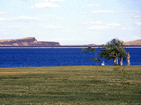
The potholes that give this reservoir its name are not gentle depressions but violent excavations -- deep cylindrical holes bored into solid basalt by kolks, the underwater tornadoes that formed when the Missoula Floods cascaded across the Quincy Basin. These spinning vortices of debris-laden water drilled into the rock with enormous force, some carving potholes more than 50 feet deep. The floods poured into the Quincy Basin from multiple directions, creating a chaos of currents and counter-currents that generated kolks across the basin floor. When the floodwaters receded, they left behind a landscape of circular depressions that eventually filled with water to become the interconnected lakes and wetlands of Potholes Reservoir. Today the reservoir attracts anglers, boaters, and bird watchers drawn to the rich habitat created by this violent geological history. The basalt cliffs surrounding the reservoir expose columnar jointing -- the geometric cooling pattern of ancient lava flows -- that was fractured and ripped apart by the flood's hydraulic force. Paddle or boat through the potholes and you are navigating through the drill marks of the most powerful flood system in Earth's recorded geological history.
Open year-round at 6762 SR-262 East, Othello, WA. 121 standard campsites, 60 full-hookup sites, and 5 cabins. Discover Pass required for day use ($10 day / $45 annual). 6,000 feet of shoreline on Potholes Reservoir (also called O'Sullivan Reservoir), formed by the 1949 O'Sullivan Dam.
Potholes State Park sits within the southern Quincy Basin near the head of the Drumheller Channels. The "potholes" of the park name are not pre-existing flood potholes in basalt, they are the small lakes and ponds that dot the dune topography of the Drumheller-Othello scabland and the sand-dune fields built from reworked flood-deposited Ephrata Fan sediments. The reservoir is artificial (1949), but it floods a portion of the Drumheller Channels and lies directly on the flood path that came out of the Grand Coulee and through the Quincy Basin. This is a useful basecamp for visiting Drumheller Channels, Frenchman Coulee, and Potholes Coulee rather than itself being a primary flood-erosion site.
No site-specific recent flood research. The reservoir's sediment record has been studied for Columbia Basin Project irrigation hydrology rather than Pleistocene events.
Covered by the IAFI Lake Lewis Chapter and Lower Grand Coulee Chapter; not itself a dedicated interpretive site for floods.
Best as a camping basecamp from spring through fall. Use the park as a hub for day trips to Drumheller Channels (10 minutes south), Frenchman Coulee (30 minutes west), and Crab Creek.
Flood-extent overlay shows the maximum reach of the Missoula Floods.
The site in its place along the flood path, with the maximum flood extent drawn over the modern map.
View on the interactive map Searchable sites · 360° trails · flood reconstruction