 Washington
Washington
Washington
Washington's official state waterfall plunges 198 feet into a churning basalt bowl that has been carved by water for over 13,000 years, and the story of how it got here is as dramatic as the falls themselves. Before the Missoula Floods,...
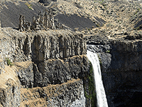
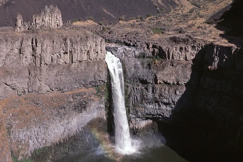
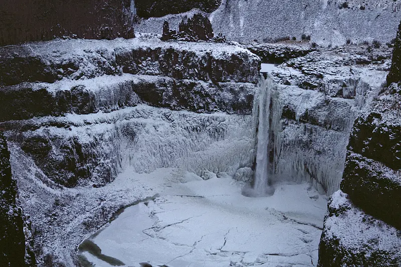
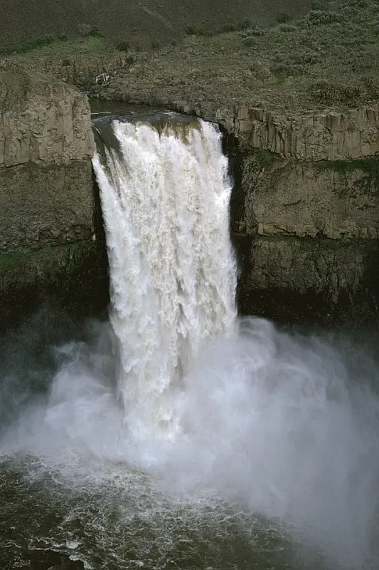
Washington's official state waterfall plunges 198 feet into a churning basalt bowl that has been carved by water for over 13,000 years, and the story of how it got here is as dramatic as the falls themselves. Before the Missoula Floods, the Palouse River flowed in a completely different channel miles to the north. The cataclysmic floodwaters ripped a new canyon through the basalt, rerouting the river and creating a series of waterfalls, of which Palouse Falls is the last one still flowing year-round. The Palouse Indians called it 'Aput Aput' -- 'falling water' -- and told stories of a giant beaver whose tail slaps created the falls and the bowl below. The columnar basalt walls surrounding the plunge pool expose multiple layers of ancient lava flows, each one laid down millions of years before the floods arrived to carve through them in mere hours. Three separate viewpoints offer perspectives on the falls: the lower overlook provides a head-on view, the interpretive path tells the geological story, and the Fryxell Overlook delivers a panoramic sweep of the entire Palouse River Canyon. Named the state waterfall in 2014 thanks to schoolchildren from nearby Washtucna, Palouse Falls is living proof that the Ice Age Floods are still shaping the landscape today.
Open year-round. A Washington Discover Pass ($10 day, $30 annual) is required. All trails into the canyon and down to the falls base are permanently closed; visitors are restricted to the rim viewing areas, including an ADA-accessible paved path with interpretive panels. Parking is small and fills on summer weekends; no trailer or RV parking.
Palouse Falls is the textbook example of a recessional cataract in the Channeled Scabland. The ancestral Palouse River flowed west to the Columbia near Washtucna; Missoula floodwaters overtopped the Snake River divide, cut a new straight channel south along a basalt fracture zone, and pirated the Palouse into its current course to the Snake near Lyons Ferry. As successive floods stripped basalt blocks off the cliff edge, the cataract retreated upstream roughly five miles to its present position. The plunge pool is excavated into Wanapum and Grande Ronde basalts of the Columbia River Basalt Group; clastic dikes are visible in the canyon walls. The largest floods responsible, including the 18.2 ± 1.5 ka event dated by Balbas et al. (2017), passed through this drainage system.
The Geological Society of America volume Floods, Faults, and Fire (2017) includes a chapter by Carson and others on the geologic and anthropogenic history of Palouse Falls, including fracture-controlled erosion and the receding-falls model. No major site-specific updates since.
The IAFI Palouse Falls Chapter (covering western Whitman, northern Franklin, and all of Adams counties) is named for this site and routinely uses it as a primary interpretive stop.
Best in spring (April–May) when peak Palouse River flow turns the cataract into a 200-foot waterfall; flow drops sharply by July. Allow 1–2 hours for the rim viewpoints and interpretive walk. Washington's official state waterfall.
Palouse Falls State Park, dedicated in 1951, is a 94-acre park showcasing the dramatic Palouse Falls and its unique geological history. The park is a popular destination for viewing the falls, which were formed by Ice Age floods and are a key part of the Ice Age Floods National Geological Trail. The falls were designated as Washington’s state official waterfall in 2014, thanks to the advocacy of schoolchildren from Washtucna.Palouse Falls is one of four of the last remaining year-round waterfalls on the Palouse River that once stood in the path of the ice age floods. It is rich in both geological and human history.
The native Palouse Indians called it“Aput Aput” meaning “falling water.” They believed that it was created by the Great Spirit because of his displeasure with the wicked Indians who lived further upstream. This obstacle was a barrier that allowed the salmon to travel no further. Sam Fisher, a Palouse Indian, also tells the story of how four giant brothers and their giant sister used oil from beaver tails to keep their hair shiny. Needing more oil, they searched for the giant beaver and fought with him. All four falls on the river were made when the beaver slapped his tail. At the last battle at Palouse Falls, the beaver struck his tail one last time creating the falls and the bowl it falls into. The vertical cracks in the basalt were made by the claws of the beaver.
Palouse Falls has made a powerful impression on all who have visited. For example, one of the fall’s earliest visitors, Laurence L. Dodd in 1867, described the site he saw this way: “just before descending the Snake River hill your eye rests on the grateful green bottom of the Palouse with its clear and pure waters, flowing into the turbid Snake and after ascending the Snake River hill to the northward and eastward, the eye sweeps over a vast extent of country rarely surpassed in rugged desolation and wildness.…” Dodd was accompanied by a few local citizens from Starbuck on horseback to witn



Flood-extent overlay shows the maximum reach of the Missoula Floods.
The site in its place along the flood path, with the maximum flood extent drawn over the modern map.
View on the interactive map Searchable sites · 360° trails · flood reconstruction