 Oregon
Oregon
Oregon
Oregon's tallest waterfall at 620 feet exists in large part because the Ice Age Floods dramatically deepened the Columbia River Gorge, creating the steep walls from which Multnomah Falls and dozens of other waterfalls now plunge. Five...
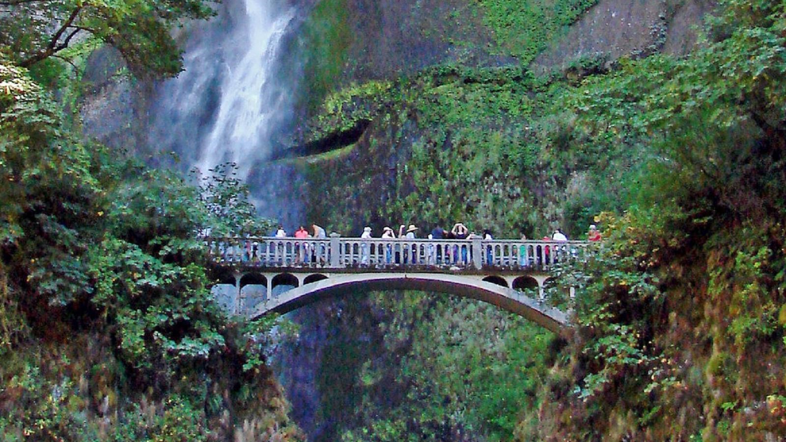
Oregon's tallest waterfall at 620 feet exists in large part because the Ice Age Floods dramatically deepened the Columbia River Gorge, creating the steep walls from which Multnomah Falls and dozens of other waterfalls now plunge. Five layers of Columbia River basalt are exposed behind the falls -- ancient lava flows laid down millions of years apart, now sliced open by the floods' canyon-carving force. During the floods, this entire section of the gorge was submerged under hundreds of feet of turbulent floodwater, and the hydraulic forces stripped away rock and widened the canyon, steepening the walls and creating the conditions for the waterfall's year-round flow. Fed by rainwater and snowmelt, Multnomah Falls is the most visited outdoor attraction in the Pacific Northwest, drawing visitors just 30 minutes east of Portland. The historic Multnomah Falls Lodge, built in 1925 at the base of the falls, houses a restaurant and Forest Service interpretive center. The steady flow cascading over those ancient basalt layers is a reminder that the Ice Age Floods are still shaping Oregon's landscape: every drop traces a path carved by water thousands of times more powerful.
The U.S. Forest Service information center inside Multnomah Falls Lodge is open daily 9 a.m.–5 p.m. The lodge restaurant and gift shop remain open, but the indoor restrooms are closed for renovation through November 2026 (portable toilets are on site). A Timed Use Permit is required to use the I-84 Exit 31 parking lot daily 9 a.m.–6 p.m. from May 22–September 7, 2026; bicycle access and a small number of free walk-up permits from Troutdale and Cascade Locks are available.
The 620-foot waterfall plunges over a stack of six Grande Ronde Basalt flows that the Missoula Floods exposed by stripping the soft sedimentary cover off the south wall of the Columbia River Gorge. During the largest floods, water depths through the Gorge here exceeded 600–800 feet, with current velocities high enough to scour the lower bedrock and undercut the basalt cliffs. The hanging-valley geometry that allows the falls to exist is itself a flood-erosion feature: tributaries like Multnomah Creek were left perched after the Columbia trunk channel was deepened. The Balbas et al. (2017) ¹⁰Be ages put the largest of these events at 18.2 ± 1.5 ka. Smaller seasonal flow today is sustained by Larch Mountain springs, not the floods, but the cliff geometry is entirely a flood-era inheritance.
The 2020 USGS/Waitt review by O'Connor, Baker, Waitt and others (published in Earth-Science Reviews) is the standard synthesis covering the Gorge corridor. No site-specific peer-reviewed work on Multnomah Falls itself has appeared since.
The IAFI Columbia River Gorge Chapter covers this site and runs semi-annual field trips through the Gorge. IAFI's interpretive write-up of "Multnomah Falls and Lodge" treats the lodge as a primary interpretive stop on the National Geologic Trail.
Best visited spring through early fall; winter access is possible but the Historic Columbia River Highway segment immediately east is closed for construction through spring 2026. The paved viewing plaza is wheelchair-accessible; the 1.2-mile switchback trail to the upper falls climbs 600 vertical feet.
Ice Age Floods National Geologic Trail,Lewis & Clark National Historic Trail
Oregon’s tallest waterfall (620 ft.) is just 30 minutes east of Portland and 30 minutes west of Hood River. Offering scenic splendor and a gateway to the Gorge’s Waterfall Corridor, the waterfall is the most visited outdoor attraction in the Pacific Northwest due to its constant flow and proximity to the Historic Columbia River Highway.
The falls are fed by rainwater and snow-melt, and its steady stream runs year-round, making it a four-seasons attraction. The highest volume comes in winter and spring, and the waterfall sometimes freezes partially at the height of winter.
Located at the base of the waterfall, Multnomah Falls Lodge built in 1925 has excellent views and is home to a restaurant, gift shop, espresso bar and U.S. Forest Service interpretive center.
The I-84 parking lot is the only way to access to the falls; parking or stopping is not allowed on the historic highway. It is recommended to visit at off-times, i.e. early morning or mid week. You can also take a guided tour or ashuttle.
Visit ourIce Age Floods Institute Field Guides Pagefor more information on Multnomah Falls and other attractions!
Visit us atFacebook,Mastodonand ourYouTube Channel.
Ice Age Floods Institute is a 501(c)(3) tax-exempt non-profit EIN 91-1658221Donations and member fees may be tax deductible

Flood-extent overlay shows the maximum reach of the Missoula Floods.
The site in its place along the flood path, with the maximum flood extent drawn over the modern map.
View on the interactive map Searchable sites · 360° trails · flood reconstruction