 Montana
Montana
Montana
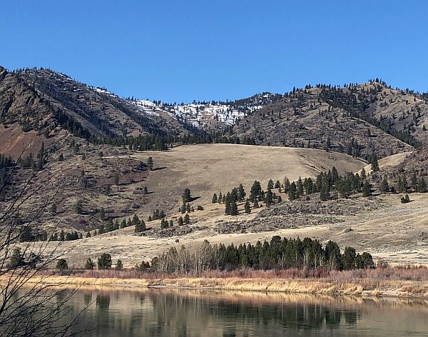
Along the Flathead River in Montana, side gulches and tributary valleys contain mounds of soil, sand, gravel, and coarse material covered with light vegetation -- gulch fills deposited when Glacial Lake Missoula's floodwaters swept through...
Along the Flathead River in Montana, side gulches and tributary valleys contain mounds of soil, sand, gravel, and coarse material covered with light vegetation -- gulch fills deposited when Glacial Lake Missoula's floodwaters swept through this area. Little Money Creek preserves one of the clearest examples of this phenomenon: as the lake rose, its waters flowed into side drainages and deposited enormous quantities of sediment, effectively plugging the gulches with flood debris. When the lake drained, these fills were left behind as elevated terraces of unconsolidated material that are now slowly eroding and revegetating. The fills record the lake's repeated rise and fall cycles in their layered sediments, with coarser material deposited during turbulent inflow and finer silts settling during periods of calm. These unassuming mounds of rubble are important geological evidence, confirming the extent and depth of Glacial Lake Missoula in these tributary valleys. The interpretive signage along the Flathead River corridor helps visitors recognize these features in the landscape. Without the signs, you might drive right past -- but once you see them, they transform the valley into a readable record of catastrophic flooding.
Roadside pullout on Montana SR 200 along the Flathead River between Perma and Paradise, Montana. Free, year-round. Known as "Stout's Bar." No facilities, pull off, read the interpretive sign, look at the gulch. Best treated as a quick stop on a Camas Prairie drive.
Little Money Creek Gulch Fill is an erosional and depositional record of the Missoula Floods running backward, outflow from Glacial Lake Missoula draining catastrophically through the constricted Eddy Narrows section of the Clark Fork valley. As lake water rushed downstream, eddy currents in tributary side gulches deposited coarse gravel beds; modern erosion has cut a section through one such fill, exposing roughly 700 feet of stratified flood gravel above the modern river. The exposure shows that floodwater filled the valley at least to that elevation, more than 600 feet above today's stream. The estimated discharge through this constriction was on the order of 8–10 cubic miles per hour during peak flood, orders of magnitude beyond modern river flow. This is one of the trail's best examples of how to read the floods' size from a single roadside exposure.
No site-specific updates since Pardee's foundational work in the 1940s and subsequent USGS and Montana Bureau of Mines characterization of the Eddy Narrows reach. The 18.2–14 ka chronology from Balbas et al. (2017) applies broadly.
The Glacial Lake Missoula Chapter (Missoula) covers the site and includes it on chapter field-trip itineraries. An IAFI/NPS interpretive sign is in place at the pullout.
Best April through October; the road is plowed but exposed gulch faces are easier to read without snow. Combine with a Camas Prairie Giant Ripples visit 12 miles north and the Paradise Center community interpretive stop.
Flood-extent overlay shows the maximum reach of the Missoula Floods.
The site in its place along the flood path, with the maximum flood extent drawn over the modern map.
View on the interactive map Searchable sites · 360° trails · flood reconstruction