 Oregon
Oregon
Oregon
Lewis and Clark saw Hat Rock in 1805 and noted its striking resemblance to a man's hat -- a distinctive basalt formation standing alone in a landscape of rolling hills near Hermiston, Oregon. But the explorers could not have known that...
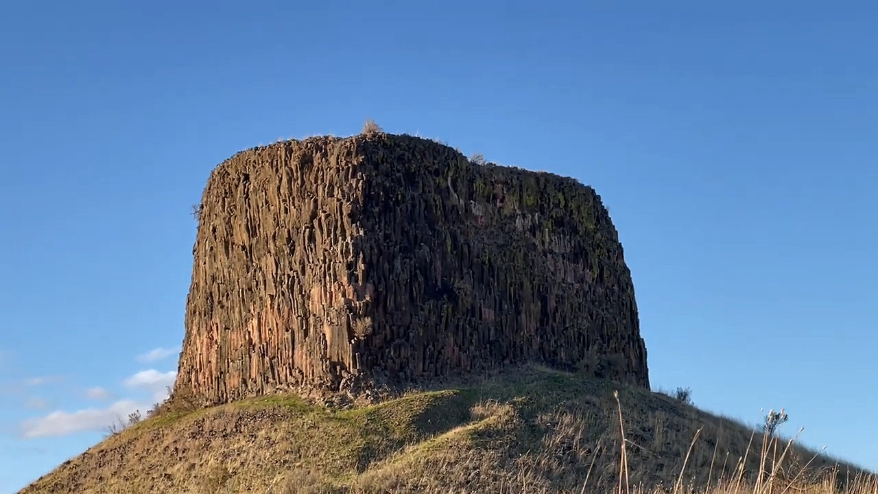
Lewis and Clark saw Hat Rock in 1805 and noted its striking resemblance to a man's hat -- a distinctive basalt formation standing alone in a landscape of rolling hills near Hermiston, Oregon. But the explorers could not have known that this otherworldly monolith was sculpted by the Missoula Floods, which stripped away softer surrounding material from a Columbia River basalt flow and left only this resistant core standing. The floods reached this area after pouring through Wallula Gap and spreading into the lowlands around the Columbia, with floodwaters estimated at hundreds of feet deep sculpting the terrain with enormous erosive force. Hat Rock is an erosion remnant, worn down by catastrophic floods from glaciers that melted over 13,000 years ago -- and its isolation in the landscape makes the floods' selective destruction dramatically visible. The park surrounding the rock offers hiking, fishing in a stocked pond with rainbow trout, access to a lake for water sports, and lush trees in otherwise arid terrain. Imagine seeing this boulder-shaped-like-a-hat for the first time in an unexplored landscape, as Lewis and Clark did -- it is still just as remarkable today.
Open year-round, day-use only. Oregon State Parks day-use parking fees apply ($5 per vehicle as of 2026) or annual Oregon Pacific Coast Passport. Located on the south shore of Lake Wallula (the Columbia River reservoir behind McNary Dam), 9 miles east of Umatilla, Oregon. Standard restrooms, picnic, and small reservoir-side beach.
Hat Rock is an erosional remnant of Columbia River Basalt, specifically the Frenchman Springs Member of the Wanapum Basalt (~15 Ma), that the Missoula Floods sculpted into its hat shape by quarrying around it. The site sits inside Wallula Gap's eastern approach, where Missoula floodwaters were forced through a constriction roughly 1 mile wide and backed up to form temporary Lake Lewis (high-water marks around 1,250 feet asl). At Hat Rock's elevation (~285 feet), the floods passed roughly 800–900 feet over the present landscape. The rock's preservation, while neighboring basalt was stripped away, comes from a more resistant flow top and the protective hydrodynamics around isolated knobs. William Clark named it on October 19, 1805, on the descent of the Columbia.
No site-specific updates found since the Balbas et al. (2017) flood chronology. Bjornstad and Kiver's On the Trail of the Ice Age Floods (2nd ed. 2022, Keokee Books) still treats Hat Rock as a teaching stop for flood-sculpted basalt remnants.
The Lower Columbia Chapter and the Ellensburg Chapter both include Hat Rock on their field-trip rotations. IAFI maintains a feature page for the park and a printable site brochure.
Best spring through fall; summer is hot (Umatilla County regularly exceeds 100°F July–August). A short 1-mile loop around the rock and adjacent lagoon is the standard visit.
Ice Age Floods National Geologic Trail,Lewis & Clark National Historic Trail
Hat Rock is an erosion remnant warn way by floods from glaciers which melted over ten thousand years ago.
Lewis and Clark saw this monument on their expedition and noted that it had a strong resemblance to a man’s hat. Imagine seeing this otherworldly boulder in the middle of a field of rolling hills in a vast, unexplored territory. The members of the expedition must have felt like they were on a different planet!
While visiting Hat Rock today doesn’t have the same element of surprise, visitors will be able to enjoy a truly unique and beautiful landscape. The main attraction is of course, Hat Rock, and most people hike in the park to admire its natural beauty.
Outside of Hat Rock, there are fields of scrub-land peppered with flowers as well as lush trees surrounding bodies of water. The park has its own pond, which is popular for fishing as it is teeming with rainbow trout. It also has access to a lake, a great place for water sports, and a sand volleyball court near the weather shelters.
It is a perfect place for the whole family to experience the beauty of Oregon along the Columbia River.
Visit us atFacebook,Mastodonand ourYouTube Channel.
Ice Age Floods Institute is a 501(c)(3) tax-exempt non-profit EIN 91-1658221Donations and member fees may be tax deductible
Flood-extent overlay shows the maximum reach of the Missoula Floods.
The site in its place along the flood path, with the maximum flood extent drawn over the modern map.
View on the interactive map Searchable sites · 360° trails · flood reconstruction