 Washington
Washington
Washington
The largest hydroelectric facility in the United States sits almost exactly where the Okanogan Lobe of the Cordilleran Ice Sheet blocked the Columbia River and set the stage for the entire Ice Age Floods saga. Grand Coulee Dam, generating...
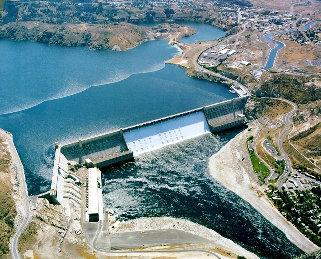
The largest hydroelectric facility in the United States sits almost exactly where the Okanogan Lobe of the Cordilleran Ice Sheet blocked the Columbia River and set the stage for the entire Ice Age Floods saga. Grand Coulee Dam, generating over 6,800 megawatts of power, was built at this location precisely because the ice age geology made it ideal: the narrow basalt canyon carved by the floods provided perfect dam abutments. The Visitor Center tells the story of both the dam and the ice age events that shaped this landscape, sitting near the spot where a glacier thousands of feet thick once sealed the Columbia River and created Glacial Lake Columbia. When that lake combined with Glacial Lake Missoula's outburst floods, water was forced southward to carve the Grand Coulee -- the very canyon that inspired the dam's name and location. The nightly laser light show projected on the dam's 550-foot-wide spillway face is impressive, but the real show happened 15,000 years ago when floodwaters equivalent to ten times every river on Earth thundered past this exact spot. The Visitor Center provides a rare opportunity to stand at the intersection of ice age geology and modern engineering ingenuity.
Open daily 8:30 a.m.–5 p.m. Pacific, closed Thanksgiving, Christmas, and New Year's Day. Admission is free; the Bureau of Reclamation operates the facility. The "One River, Many Voices" laser light show and the John W. Keys III Pump-Generating Plant guided tours resume seasonally each May 22.
The dam was built across Upper Grand Coulee, a 50-mile-long chasm carved by Missoula Floods after the Okanogan Lobe blocked the Columbia River's pre-flood channel and forced floodwater south across the Waterville Plateau. Balbas et al. (2017) dated full opening of Upper Grand Coulee as a flood route to 15.6 ± 1.3 ka, after which it became the primary path for later Missoula floods until the last ones at 14.7 ± 1.2 ka. From the visitor center overlook, the relationship between modern engineered concrete (550 feet tall) and the natural cataract retreat that produced the coulee is unusually legible. Coulee floors at Banks Lake immediately south are roughly 800 feet below the basalt rim, most of that depth was excavated by flood waters quarrying jointed basalt columns. The dam is on the rim of the Channeled Scablands, the landscape Bretz coined in 1923.
Balbas et al. (2017) used cosmogenic ¹⁰Be dating on Upper Grand Coulee terraces to bracket the active flood-cataract period to 18.2–14 ka, with Upper Grand Coulee fully open after 15.6 ka. Waitt and O'Connor (2021, in Earth-Science Reviews) consolidated the Missoula and Bonneville flood record and reaffirmed the Grand Coulee cataract retreat sequence.
No dedicated IAFI chapter is based at the dam, but the Wenatchee Valley Erratics chapter and Cheney-Spokane chapter both run field trips through the upper coulee. The Bureau of Reclamation visitor center exhibits emphasize hydropower; flood geology is covered by interpretive signage on the surrounding Coulee Corridor National Scenic Byway rather than inside the building.
Best from May through September when tours and the evening laser show run. The overlook on SR 174 north of the dam and the Crown Point Vista (off SR 174 east of the dam) give the cleanest views of the coulee walls and the relationship between dam, river, and coulee.
Ice Age Floods National Geologic Trail|Columbia Basin Project
The Columbia Basin Project, which includes Grand Coulee Dam as its main feature, is the Bureau of Reclamation’s largest multipurpose project.
Grand Coulee Dam includes three major hydroelectric power generating plants and a pump generating plant. The facilities provide power generation, irrigation, flood control, stream flow regulation for fish migration, navigation, and recreation.
When the final generator came online at the Nathaniel Washington Power Plant in in 1980, Grand Coulee Dam became the largest hydropower generating complex in the United States with a generating capacity of more than 6,809-megawatts supplying up to 21 billion kilowatt hours of electricity. In addition, Canada receives power under the Columbia River Treaty.
Grand Coulee Dam is operated as part of a coordinated federal system of hydroelectric facilities, which provides 35% of the entire power supply of the Pacific Northwest. The Columbia Basin Project consists of 330 miles of major distribution canals, lakes and reservoirs, and about 2,000 miles of laterals that currently irrigate approximately 680,000 acres of land. In addition, Grand Coulee Dam funds a complex of three hatcheries, Leavenworth, Winthrop and Entiat, collectively known as the Leavenworth Complex, to mitigate for the loss of anadromous fish above the dam. Over 2 million spring chinook and summer steelhead are raised annually.
The economic values of the Columbia Basin Project include irrigated crops valued at $1.2 billion annually, hydropower production of approximately $500 million annually, and the prevention of more than $206 million in flood damages since 1950. The Columbia Basin Project also resulted in the creation of vast wetlands and riparian areas and provides recreation benefits to about four million visitors each year.
This project made the development of the Pacific Northwest possible and its importance to the nation has been profound. Its influence
Flood-extent overlay shows the maximum reach of the Missoula Floods.
The site in its place along the flood path, with the maximum flood extent drawn over the modern map.
View on the interactive map Searchable sites · 360° trails · flood reconstruction