 Washington
Washington
Washington
Two geological dramas separated by 15 million years collide at Ginkgo Petrified Forest: an ancient forest turned to stone by volcanic processes, then exposed and reshaped by the Missoula Floods. The park preserves one of the most diverse...
Two geological dramas separated by 15 million years collide at Ginkgo Petrified Forest: an ancient forest turned to stone by volcanic processes, then exposed and reshaped by the Missoula Floods. The park preserves one of the most diverse collections of petrified wood in North America, with over 200 species of trees that were buried by Columbia River basalt flows roughly 15 million years ago, their cells slowly replaced mineral by mineral into exact rock replicas. Then, 15,000 years ago, the Ice Age Floods came roaring through, carving the cliff face where the Interpretive Center now perches and scattering ice-rafted glacial erratics -- boulders from distant mountains -- among the petrified stumps. Washington's official state gem is petrified wood, and rare ginkgo specimens discovered here in 1932 gave the 7,124-acre park its name. The Trees of Stone Interpretive Trail winds past more than 20 petrified logs in their original settings, while golden eagles, bighorn sheep, and sage thrashers inhabit the surrounding basalt steppe. From the Interpretive Center, look out over the Columbia River valley and trace the flood's path carved into the walls of basalt on either side.
Ginkgo Petrified Forest State Park covers 7,124 acres on the west side of the Columbia River at Vantage, Washington. The Interpretive Center is open Thursday–Monday with summer hours 6:30 a.m.–dusk and winter hours 8 a.m.–dusk; closed October 10–16 and November 1–2. A Discover Pass is required for parking. Group tours by appointment for a fee.
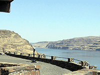
The interpretive center is perched on a basalt cliff carved out by Missoula floodwaters running south through the Columbia River channel. Floodwaters in this reach scoured the canyon walls up to roughly 600 ft above the present river, and slackwater pooling reached over 1,200 ft elevation behind the Wallula Gap constriction, high enough that floating icebergs grounded and dropped erratics on the upper plateau above Vantage. The park is fundamentally a petrified-wood site (Miocene forest preserved by Columbia River Basalt flows roughly 15 Ma), but the modern landscape and the cliff exposures are products of the 18.2–14 ka flood cycles.
No site-specific flood research published since 2017. Petrified-wood paleobotanical studies continue but are outside the flood-context scope. No flood-related updates found since the Balbas et al. 2017 chronology.
Within the Wenatchee/Ellensburg chapter's territory; the interpretive center includes Ice Age Floods displays.
Year-round; the interpretive center is the marquee draw, with petrified-wood specimens and exhibits on both the Miocene forest and the floods. The trail loop above Vantage offers a short walk past in-situ petrified logs.
Did you know that petrified wood is Washington’s official state gem? Considered one of the most diverse fossil forests in North America, Ginkgo Petrified Forest State Park is famous for its rare specimens of petrified Ginkgo tree discovered there in 1932.
Curious? Drive to the park interpretive center and take in the big skies, Columbia River views and outdoor exhibits of petrified wood. Look for evidence of Ice Age Floods carved into the walls of the Columbia River. Then step inside the Ginkgo Petrified Forest Interpretive Center which features more than 30 varieties of petrified wood, including a display of rare ginkgo petrified wood.
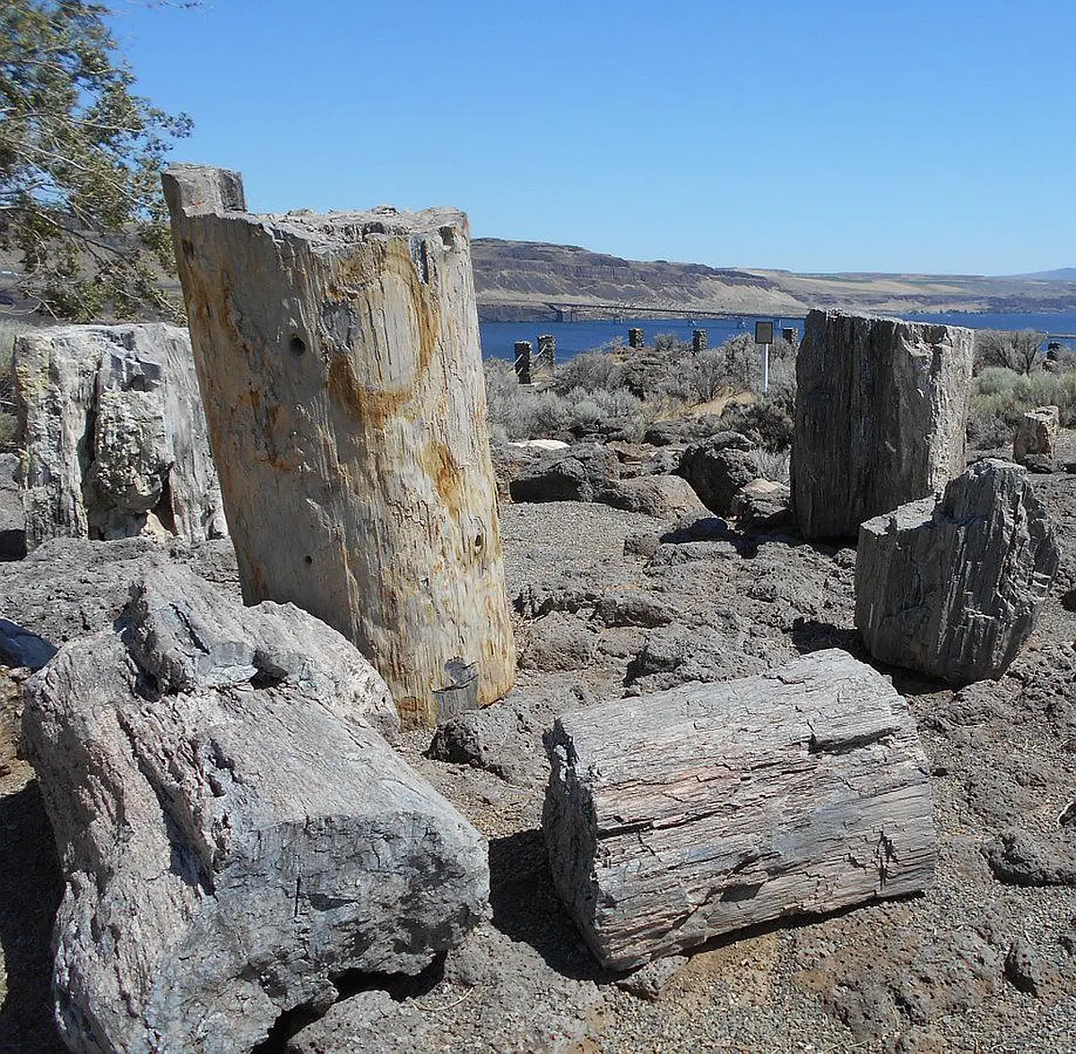
Drive the Old Vantage Highway to the Ginkgo “trailside museum,” constructed by the Civilian Conservation Corps in the 1930s, and recently updated with a new interpretive exhibit. From here, the Trees of Stone Interpretive Trail winds past more than 20 petrified logs in their original settings. Birders, look for golden eagles, sage thrashers, Say’s phoebes and many other species. Elk and bighorn sheep also frequent this area.
You may want to reserve a campsite at nearby Wanapum Recreation Area so you can cap off a hot day with a refreshing swim or boat float in Wanapum Lake (a reservoir on the Columbia River). Pitch your tent or connect your RV, make a picnic under a shady tree, and savor this green oasis.
Ginkgo Petrified Forest State Park is a 7,124-acre park with camping at Wanapum Recreation Area. The park features 27,000 feet of freshwater shoreline on the Wanapum Lake along the Columbia River. Ginkgo Petrified Forest is a registered National Natural Landmark.
Ginkgo Petrified Forest State Park is comprised of three primary locations. See tabs below for more information on specific opportunities within each area of the park.
Automated pay stations:This park is equipped with automated pay stations for visitors to purchase a one-day or annual Discover Pass and boat launch permit.
Electric-vehicle charging station:The park of



Flood-extent overlay shows the maximum reach of the Missoula Floods.
The site in its place along the flood path, with the maximum flood extent drawn over the modern map.
View on the interactive map Searchable sites · 360° trails · flood reconstruction