 Washington
Washington
Washington
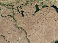
The Drumheller Channels are the most spectacular example of 'butte-and-basin' scabland terrain on the Columbia Plateau -- a surreal landscape of hundreds of steep-sided basalt buttes separated by a braided network of dry channels, all...
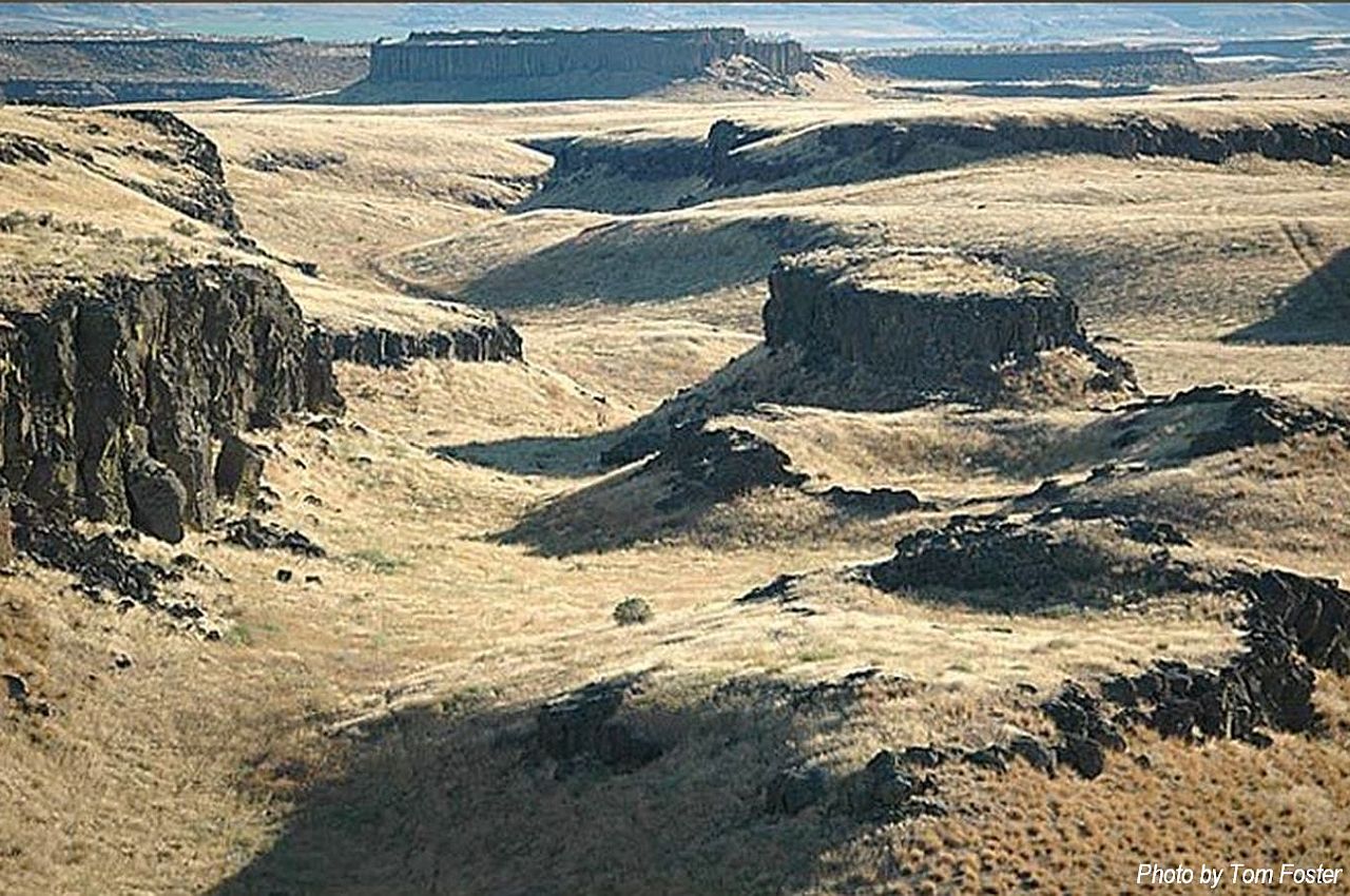
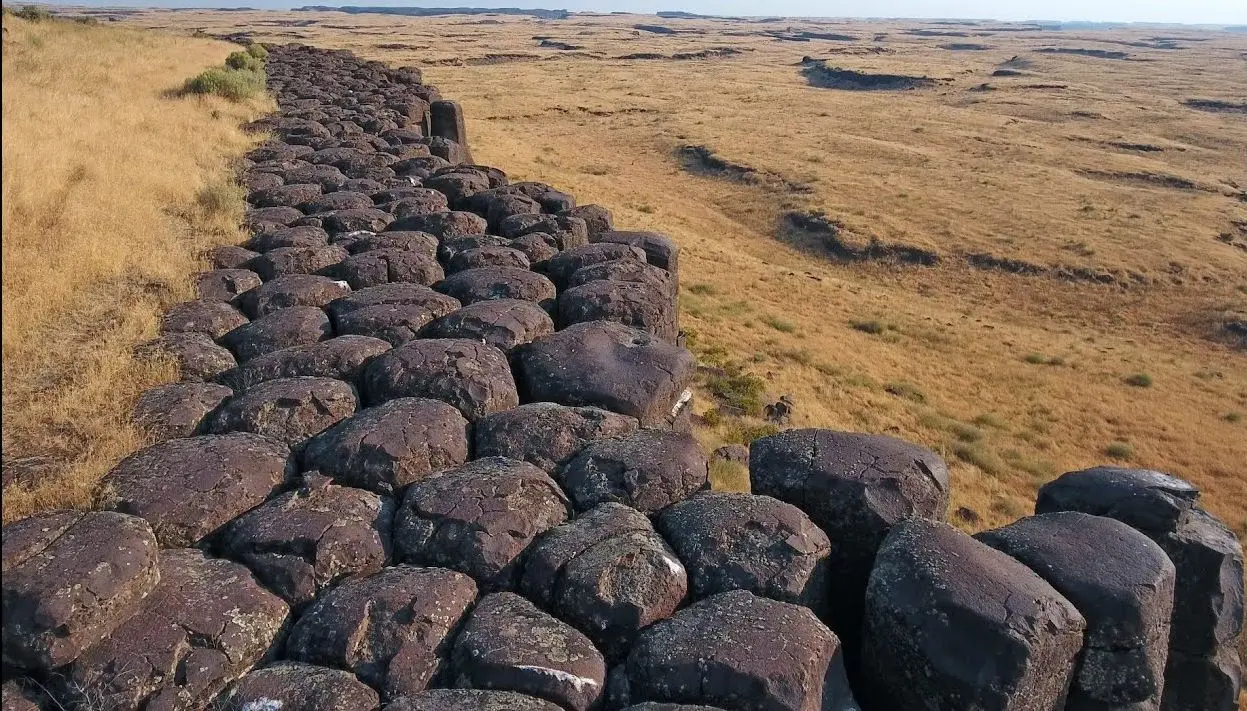
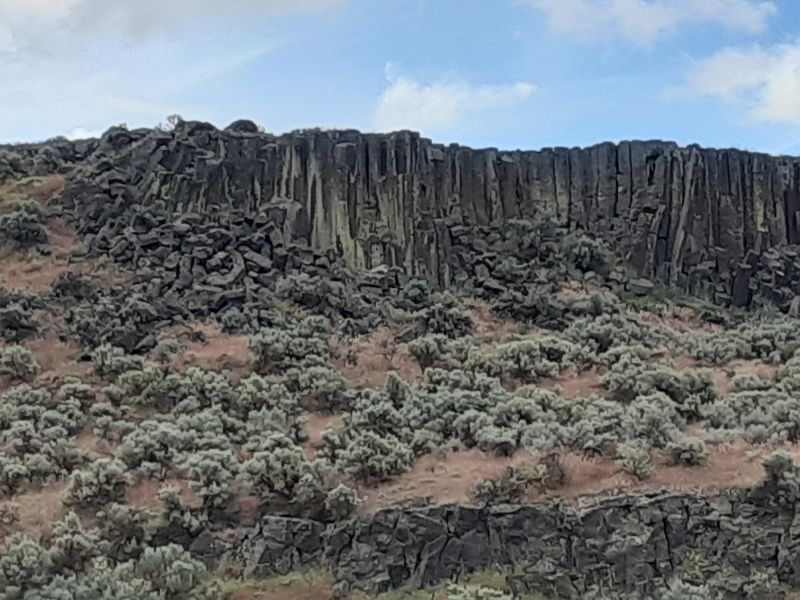
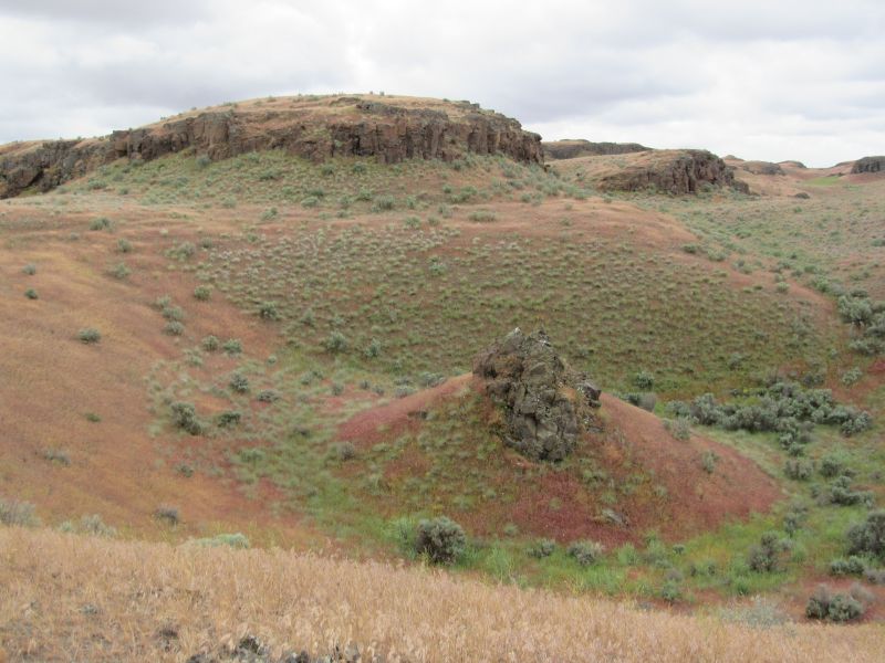
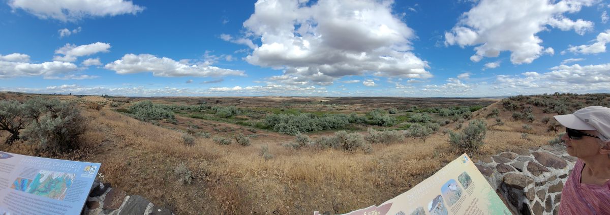
The Drumheller Channels are the most spectacular example of 'butte-and-basin' scabland terrain on the Columbia Plateau -- a surreal landscape of hundreds of steep-sided basalt buttes separated by a braided network of dry channels, all carved by the Missoula Floods. Unlike the Grand Coulee, where a single massive channel was carved, the floods here split into dozens of interlocking streams that wove around resistant basalt knobs, creating a maze-like terrain that extends for miles south of Potholes Reservoir. Designated a National Natural Landmark, the channels feature towering basalt cliffs, hidden waterfalls, and Nick Zentner's famous basalt columns -- freestanding hexagonal pillars exposed when flood currents stripped away the surrounding sediment. The area is also a haven for wildlife, with over 23 species of ducks and geese, bald eagles, deer, and coyotes inhabiting the diverse ecosystem that has reclaimed the flood-carved terrain. Hiking trails wind through the channels past kolk depressions, wildflowers, and panoramic viewpoints that reveal the vast scale of the scablands from above. Stand at the Drumheller Channels National Natural Landmark overlook and you see the floods' fingerprints stretching to every horizon -- a landscape that could only have been made by water on an almost unimaginable scale.
Drumheller Channels National Natural Landmark (designated 1986) lies within the Columbia National Wildlife Refuge and BLM lands roughly 5 miles northwest of Othello. Primary public access is via a pull-off and short gravel path to a scenic overlook on West McManamon Road; the NPS-listed Rimrock Trail and Pipistrelle Cliffs Trail provide longer hikes into the channels. No fee at the overlook; refuge access is free. Year-round, though late spring is best for wildflowers and water in the channels.
Drumheller is the textbook example of basalt "butte-and-basin" channeled scabland. Six main anastomosing channels carved into the Frenchman Springs basalt host hundreds of streamlined buttes, dry coulees, plunge pools, and rock basins. The landform took shape as Missoula floodwaters spilling out of Soap Lake and the Quincy Basin spread across a 15-km-wide spillway, with flow depths exceeding 30 m and velocities estimated to 80 km/hr. More than 100 modern lakes pond on the scabland floor as a result of post-1950s Potholes Reservoir backflow and water-table rise.
Bretz's interpretation has been refined but not overturned. The Balbas et al. 2017 cosmogenic chronology placed the major flood events at 18.2 ± 1.5 ka with later flow shifts to eastern routes, consistent with Drumheller's role as a sustained scabland spillway. No updates found since 2017.
Featured site for the Lake Lewis and Lower Grand Coulee chapters; included in IAFI field-trip itineraries. NPS National Natural Landmark interpretation is present; no dedicated IAFI-branded panel at the overlook.
Late March through May for green vegetation and water in the channels; September–October for cooler hiking. The McManamon Road overlook is a 10-minute stop; serious visitors should plan 2–4 hours for the Rimrock or Pipistrelle Cliffs trails.
Nestled in the heart of Washington state, the Drumheller Channels offer a unique glimpse into earth’s history, carved by the immense power of Ice Age Floods. This National Natural Landmark is a must-visit for anyone seeking breathtaking landscapes, remarkable geological formations, and a chance to understand the power of nature.
Witness the Scars of Ancient Floods: Drumheller Channels are a remarkable example of the Channeled Scablands, a vast landscape sculpted by cataclysmic floods that roared across the region millennia ago. Hike or bike through dry riverbeds, past towering basalt cliffs, and over rolling hills, all remnants of these powerful events. Imagining the colossal force of water that once flowed through these channels is an awe-inspiring experience.
Explore Diverse Landscapes: The Channels offer a variety of landscapes, each offering its own unique charm. Hike along the McManamon Trail for panoramic vistas of the Scablands, or venture into the Crab Creek Unit to discover hidden waterfalls and basalt columns. For a unique perspective, climb to the top of “Nick’s Columns” and marvel at the vastness of the Channeled Scablands.
A Haven for Wildlife: The diverse ecosystem within the Drumheller Channels provides a sanctuary for various wildlife species. Birdwatchers can spot over 23 species of ducks and geese, while sharp-eyed visitors may catch a glimpse of deer, coyotes, and even bald eagles. The Channels are also a vital nesting ground for many birds, making it a crucial habitat for preserving regional biodiversity.
Connect with the Past: Explore the fascinating human history of the Drumheller Channels. The region has been inhabited for thousands of years, with evidence of Native American presence found throughout the area. Learn about the early settlers who braved the rugged landscape and contributed to the development of the region.
A Place for Recreation and Reflection: Whether you’re an avid hiker, a passionate photographer, or simply seeking a pea


Flood-extent overlay shows the maximum reach of the Missoula Floods.
The site in its place along the flood path, with the maximum flood extent drawn over the modern map.
View on the interactive map Searchable sites · 360° trails · flood reconstruction