 Washington
Washington
Washington
Above the tranquil surface of Deep Lake, massive potholes bored into solid basalt testify to one of the most violent hydrodynamic phenomena the Earth has ever produced. These enormous cylindrical holes -- some more than 30 feet across and...
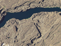
Above the tranquil surface of Deep Lake, massive potholes bored into solid basalt testify to one of the most violent hydrodynamic phenomena the Earth has ever produced. These enormous cylindrical holes -- some more than 30 feet across and equally deep -- were excavated by kolks, underwater vortices that formed when the Missoula Floods poured over the basalt ledges at speeds exceeding 60 miles per hour. The kolks acted like liquid drill bits, spinning rocks and debris against the basalt with enough force to bore perfectly circular holes into solid stone. The potholes above Deep Lake are among the most dramatic examples of kolk erosion anywhere on the Ice Age Floods trail, and their size speaks to the extraordinary depth and velocity of the floodwaters in this section of the Grand Coulee. Today Deep Lake itself fills a flood-scoured basin at the base of the coulee, and Terrain360's virtual trail allows visitors to explore the area in 360-degree immersive views. Standing above these potholes, you can almost hear the roar of water that once turned solid rock into Swiss cheese.
The Deep Lake potholes sit within Sun Lakes-Dry Falls State Park, south of Coulee City. Access is via the Deep Lake Road off SR-17, which dead-ends at a small day-use area with picnic tables and a swimming/boating beach. Open year-round for day use; a Discover Pass is required. The Dry Falls Visitor Center near the park's main entrance is closed for the entirety of 2026 for renovation, which may affect interpretive context for visitors.
The cluster of deep potholes just west of Deep Lake formed where high-velocity floodwater plunging over the Dry Falls cataract complex generated vortex erosion (kolks) that drilled cylindrical holes tens of feet deep into the underlying Columbia River Basalt. Some potholes are 40–50 ft deep; J Harlen Bretz documented them prominently in his 1932 monograph "The Grand Coulee" as the type example of kolk-cut potholes. They are part of the broader Dry Falls–Monument–Deep Lake cataract group, all carved by 18.2–14 ka Missoula floodwaters during peak flow over the cataract.
Pothole genesis interpretation has remained stable since Bretz; recent megaflood reviews (e.g., Waitt and others) and the Balbas et al. 2017 chronology have not produced new pothole-specific work. No updates found since 2017.
Within the Lower Grand Coulee chapter's geographic area. No dedicated panel at the potholes themselves; the Dry Falls Visitor Center (when open) has been the main interpretation hub.
Late spring through early fall. Good for a short walk along the basalt ledges south of the lake to see Bretz's described pothole field; combine with the Dry Falls overlook and Lake Lenore caves.
Flood-extent overlay shows the maximum reach of the Missoula Floods.
The site in its place along the flood path, with the maximum flood extent drawn over the modern map.
View on the interactive map Searchable sites · 360° trails · flood reconstruction