 Washington
Washington
Washington
At Horsethief Butte, the raw power of the Missoula Floods is written directly on the rock face in scoured channels, polished surfaces, and basalt stripped bare of soil and sediment. Columbia Hills State Park encompasses 3,338 acres along...
At Horsethief Butte, the raw power of the Missoula Floods is written directly on the rock face in scoured channels, polished surfaces, and basalt stripped bare of soil and sediment. Columbia Hills State Park encompasses 3,338 acres along the Columbia River Gorge where floodwaters, estimated at over 800 feet deep, hammered against the basalt hillsides with enough force to reshape the canyon walls. But the floods are only part of this site's extraordinary story: Native Americans have inhabited this area for over 10,000 years, leaving behind some of the most significant pictographs and petroglyphs in North America, including the famous 'She Who Watches' (Tsagaglalal), a haunting face carved into a cliff overlooking the river. The park combines Horsethief Lake, the Dalles Mountain Ranch, and Crawford Oaks, offering over 12 miles of hiking trails through landscapes where lupine and balsamroot bloom in spectacular fields of purple and gold each April. Lewis and Clark passed through here on their journey to the coast, making this a rare place where geological, archaeological, and historical narratives converge. A ranger-led tour to see 'She Who Watches' is an unforgettable experience.
Columbia Hills Historical State Park sits 6 miles east of Dallesport, Washington, on SR-14 along the north bank of the Columbia River in Klickitat County. Open 6:30 a.m. to dusk; Horsethief Lake portion closed November–March. A Discover Pass ($10/day or $45/year) is required. The Tsagaglalal "She Who Watches" petroglyph requires an advance-reservation guided tour (free); the Temani Pesh-Wa "Written on the Rock" outdoor petroglyph display is open during park hours.
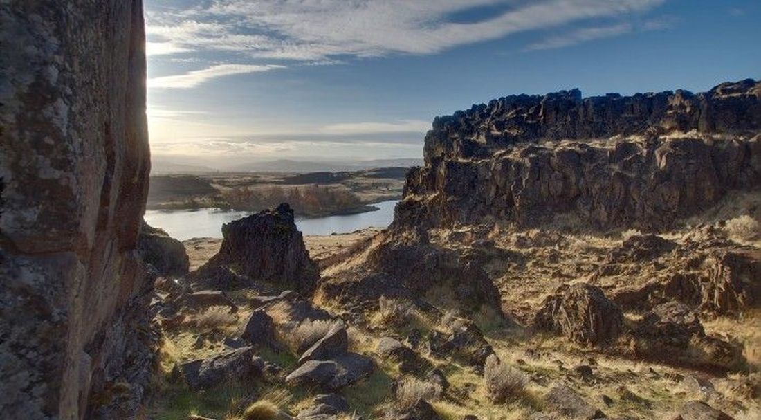
The buttes, spires, and stripped basalt benches of Columbia Hills, including Horsethief Butte, are flood-erosion features. The Missoula floods, traveling 60+ mph through the Gorge here, stripped overlying loess and soils down to the columnar basalt of the Columbia River Basalt Group and sculpted residual buttes from joint-controlled remnants. The Tsagaglalal petroglyph site is preserved on flood-scoured basalt. The petroglyphs themselves are Indigenous artwork, not flood features, but the rock surfaces they were pecked into are the floods' work. Horsethief Lake itself is a modern reservoir behind The Dalles Dam (1957), not an Ice Age feature.
No flood-specific updates found since 2017. The petroglyph and rock-art record is the subject of ongoing tribal preservation work; the geology is well-mapped.
IAFI maintains a Columbia Hills page that emphasizes the rock art over the flood erosion. The site sits within the Columbia River Gorge Chapter's coverage area. No dedicated IAFI interpretive panel documented at the park.
Best April through October. Reserve the Tsagaglalal tour weeks in advance through Washington State Parks (Friday and Saturday mornings, April–October). Allow 2–4 hours including a Horsethief Butte scramble.
Ice Age Floods National Geologic Trail,Lewis & Clark National Historic Trail
Columbia Hills State Park is a Washington State Park located 6 miles east of Dallesport on SR 14 in Klickitat County. The park occupies 3,338 acres on Horsethief Lake, an impoundment of the Columbia River, and was created in 2003 with the merger of Horsethief Lake State Park and Dalles Mountain Ranch. It also includes Horsethief Butte and Crawford Oaks, both popular hiking areas. Horsethief Lake section of the Columbia Hills Historical State Park is a National Historic Site.
Located on the site of a former Native American village, Columbia Hills State Park is along the rolling hills of the Columbia River Gorge, with nearly two miles of freshwater shoreline on the Columbia River. This made it the perfect stopping point for the Lewis and Clark expedition on their way to the coast. A group of significant Native American pictographs and petroglyphs are located in this area of the park. The Temani Pesh-Wa exhibit is open daily for self-guided viewing. The world-famous Tsagaglalal, (She Who Watches) and other pictographs and petroglyphs can be viewed by making a reservation to participate in a regularly scheduled ranger-led tour (see Interpretive Opportunities on website for registration instructions).
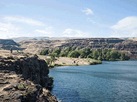
Across Highway 14 from the main part of Columbia Hills State Park, Horsethief Butte dominates the skyline, standing over Horsethief lake like an ancient castle. The lake itself is enormous, flooded into existence by the construction of The Dalles Dam. Lupine and balsamroot bloom in mid-April, making spectacular fields of purple and gold. Songbirds flit about, while larger birds of prey, like eagles and falcons, soar on air currents high above your head.
The commission combined the park with Dalles Mountain Ranch and renamed the area Columbia Hills State Park in 2003. Now, in addition to the more than 12 miles of hiking trails in the area, visitors can enjoy swimming, freshwater fishing, bird
Flood-extent overlay shows the maximum reach of the Missoula Floods.
The site in its place along the flood path, with the maximum flood extent drawn over the modern map.
View on the interactive map Searchable sites · 360° trails · flood reconstruction