 Washington
Washington
Washington
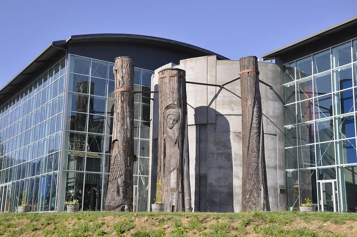
Located in the heart of the Columbia River Gorge National Scenic Area near Stevenson, Washington, the Columbia Gorge Interpretive Center Museum sits where the Missoula Floods once surged at depths of about 800 feet above the modern river...
Located in the heart of the Columbia River Gorge National Scenic Area near Stevenson, Washington, the Columbia Gorge Interpretive Center Museum sits where the Missoula Floods once surged at depths of about 800 feet above the modern river level. The museum brings to life 15,000 years of history in one of the nation's most compelling landscapes, from the Ice Age Floods that carved the gorge to the Native American peoples who have lived here for over 10,000 years. The largest gallery focuses on the timber and fishing industries, but the geological exhibits are equally compelling, showing how the floods transformed a narrow river canyon into the dramatic gorge visible today. The museum's logo is Tsagaglalal -- 'She Who Watches' -- a famous petroglyph located at nearby Columbia Hills State Park, linking the geological and cultural heritage of the gorge. The Emory Strong Library within the museum houses a significant collection of early-man artifacts, connecting the deep human history of the gorge to its geological origins. Step outside and look up the gorge walls: the scour lines and polished basalt hundreds of feet above you mark exactly where the floodwaters reached.
The Columbia Gorge Museum (formerly Columbia Gorge Interpretive Center Museum) sits at 990 SW Rock Creek Drive in Stevenson, Washington, on the Washington side of the Gorge across from Cascade Locks, Oregon. Open daily 10 a.m.–5 p.m.; admission charged (~$10 adult; confirm current rates). Operated by the Skamania County Historical Society.
The museum is a multi-theme regional museum covering the human and natural history of the Columbia Gorge. The Ice Age Floods are one of several geological storylines, integrated with Cascade volcanism, Native American history, the Bonneville Landslide, and timber, fishing, and rail industries. The flood content explains the Missoula outburst sequence, the carving of the Gorge over ~40 events, and the floods' role in producing the Gorge's signature waterfalls (Multnomah, Bridal Veil, etc., are hanging-valley features left by flood-incision of the main canyon). Treat this as a strong museum-context stop in the middle of the flood-pathway Gorge.
The 2020 O'Connor et al. USGS review consolidates Gorge-discharge estimates. No curatorial update at the museum specifically tied to post-2017 chronology is documented in the public sources.
Moderate–strong. IAFI maintains a page on the center, and the Columbia River Gorge Chapter (founded 2007) lists the Interpretive Center as one of its primary lecture venues, alongside the Discovery Center and Vista House.
Year-round. Allow 90 minutes to 2 hours. Pair with the Bonneville Dam Visitor Center (7 miles west) and Beacon Rock (15 miles west) for a Washington-side Gorge geology loop.
Ice Age Floods National Geologic Trail,Lewis & Clark National Historic Trail
“Time prints of the millennia are boldly etched on the walls of the Columbia Gorge. They record a 40-million-year-long story of change, endurance and majesty.”
Located in the heart of the Columbia River Gorge National Scenic Area, the Columbia Gorge Interpretive Center Museum brings to life the human stories and natural history of one of our nation’s most compelling landscapes. The mission of the Columbia Gorge Interpretive Center Museum is to share the story of Skamania County and the Columbia River Gorge. The Skamania County Historical Society will assemble, collect, preserve, exhibit and make available for future generations any and all historical data, information and artifacts, obtained for the education and enjoyment of Skamania County and Columbia River Gorge residents and visitors. We invite you to come experience 15,000 years of history.
The logo for the Columbia Gorge Interpretive Center is the petroglyph, “Tsagaglalal” or “She Who Watches.” Tsagaglalal is located on a cliff overlooking the Columbia River at Columbia Hills State Park (formerly known as Horse Thief State Park) in Washington. It is one of the best examples of aboriginal art in the United States.
The largest gallery in the museum is Harvesting Resources, which focuses on the timber and fishing industries in the Gorge. It also contains a waterfall. Four very large artifacts are on display.
The First Peoples exhibit focuses on the history of the original people to live in this area of the Gorge, the Cascade Chinook. The Emory Strong Library is also visible, showing his collection of early-man artifacts.
Location: 990 SW Rock Creek Dr, Stevenson, WA 98648Phone: (509) 427-8211
Visit us atFacebook,Mastodonand ourYouTube Channel.
Ice Age Floods Institute is a 501(c)(3) tax-exempt non-profit EIN 91-1658221Donations and member fees may be tax deductible
Flood-extent overlay shows the maximum reach of the Missoula Floods.
The site in its place along the flood path, with the maximum flood extent drawn over the modern map.
View on the interactive map Searchable sites · 360° trails · flood reconstruction