 Montana
Montana
Montana
Scattered across the Bitterroot Valley floor are glacial erratics -- boulders that floated on icebergs in Glacial Lake Missoula and were dropped when the icebergs melted, stranding these foreign rocks on a landscape where they clearly do...
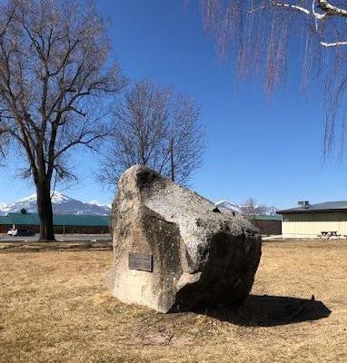
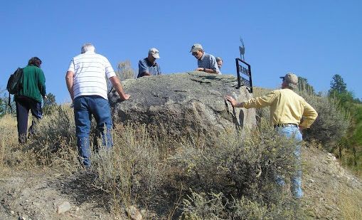
Scattered across the Bitterroot Valley floor are glacial erratics -- boulders that floated on icebergs in Glacial Lake Missoula and were dropped when the icebergs melted, stranding these foreign rocks on a landscape where they clearly do not belong. The Lone Rock School erratic, an 8.5-metric-ton block of quartz monzonite sitting in front of a rural schoolhouse, and the Rome Lane erratic nearby, were both deposited during the last high stand of Lake Missoula roughly 13,000 years ago. The icebergs that carried these boulders calved from mountain glaciers that coalesced near Lake Como at the southern end of the Bitterroot Valley -- the largest mass of calving ice south of the Flathead glacial lobe. As these bergs floated out into the lake and slowly melted, they dropped their rocky cargo onto the lake floor, which is now the valley surface. The Lone Rock School erratic reveals its origins if you look closely: quartz crystals stand out in relief, and biotite mica flecks catch the light. Both erratics are easily accessible, and their presence on the valley floor tells a story of ice, water, and deep time that connects this quiet farming valley to a catastrophe of continental proportions.
Two easily accessible erratics anchor this stop: the Lone Rock School erratic and the Rome Lane erratic, both south of Stevensville, Montana. Lone Rock School (head north on Eastside Highway 269 from Stevensville, then to county road 268) is the simpler stop, the boulder sits in front of (south side of) the school, behind a fence. Both are on or adjacent to public roads / public school property; no fees or hours apply. The Rome Lane erratic is on a county road shoulder.
These are not classic Missoula-flood erratics carried downstream by outburst waters. They were rafted into the southern Bitterroot Valley on icebergs that calved off the Cordilleran ice margin and floated into the high stand of Glacial Lake Missoula, then dropped when the icebergs grounded or melted as the lake drained. The 18,700-lb Lone Rock School boulder and the 28,600-lb Rome Lane boulder are quartz monzonite from sources well north of the valley, ferried south during a late high stand around 13 ka (per IAFI). The Bitterroot Valley filled with lake water as far south as Sula, roughly 286 miles from the ice dam.
No updates found since 2017. The luminescence work referenced by Montana Tech in 2023 dated gravel exposure ages but did not directly re-date the Bitterroot erratics.
Strong. IAFI maintains a dedicated page on the two erratics, including detailed location and access directions. The Ravalli County Museum (Hamilton) hosts an Ice Age Floods exhibit covering Glacial Lake Missoula in the Bitterroot. Site is within the IAFI Glacial Lake Missoula Chapter footprint.
Drive-up access; visits take 10–20 minutes each. Best paired with the Ravalli County Museum exhibit in Hamilton for context.

Flood-extent overlay shows the maximum reach of the Missoula Floods.
The site in its place along the flood path, with the maximum flood extent drawn over the modern map.
View on the interactive map Searchable sites · 360° trails · flood reconstruction